TAP2MAP

Capture and process aerial photos to a 3D model
- iOS
- IoT
- Romania
About Tap2Map
Tap2Map is a 3D flight planner for DJI drones, made for professional surveyors to collect aerial imagery following basic photogrammetric airborne survey rules. The product is available on iOS (version 10 or higher), for all models of the iPhone and iPad.
Users can easily define the mapped terrain, plan their drone flight way or import a pre-existing plan, track the drone as it surveys the terrain and export the photos to the preferred third-party software.

The Challenge
Tap2Map’s challenge was two-fold. From a design perspective, Tap2Map’s goal was to make a 3D flight planner that was easy to use for new adopters.
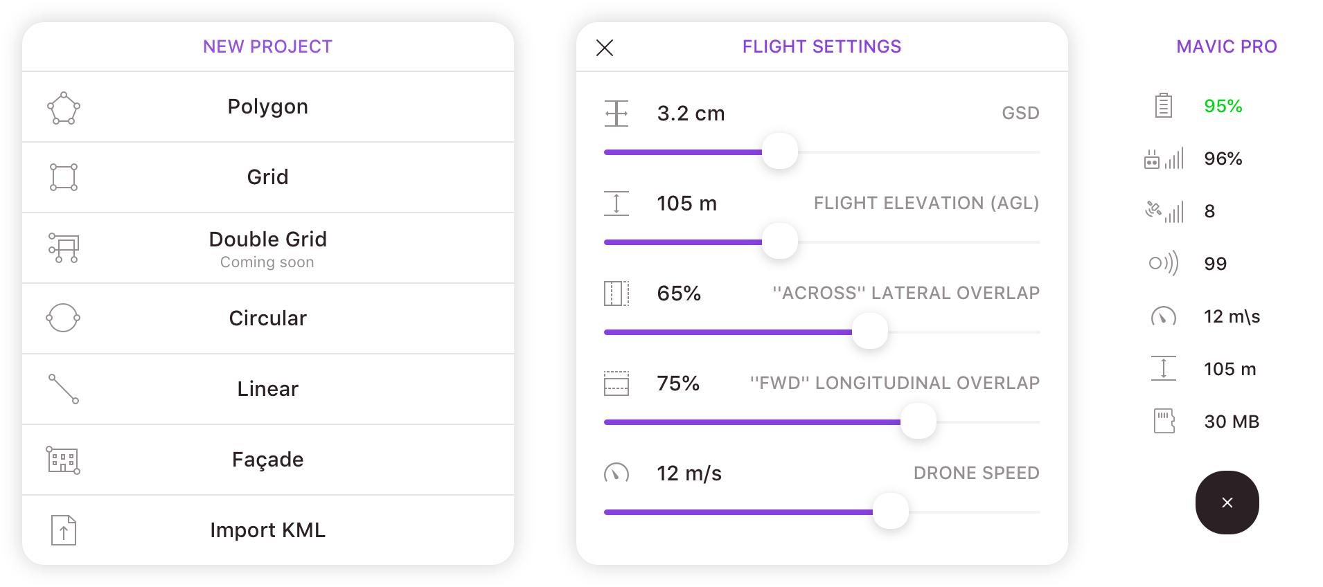
From a technical perspective, the algorithm planning the flight paths needed to take into account not only the terrain specifics (shape or altitude), but also the user’s DJI drone’s technical specifications (camera type, battery, sensors).
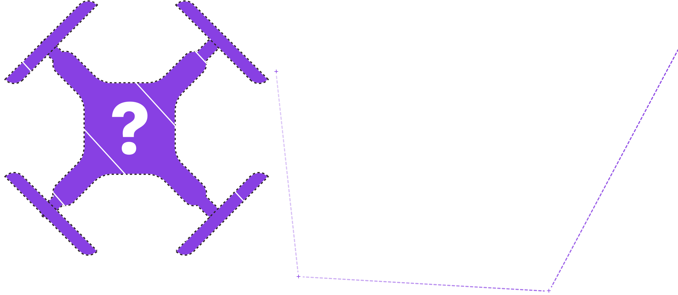
Logo & Icon
The logo of the app is a stylised representation of the two main features of the product:
- the use of drones as technical assistants
- the graphical representation of the flight plan.

Icons
Typeface

Style Guide
Tap2Map’s visual language is based on a simple color palette of purple and dark grey and the simplicity of topographic maps, including many white spaces and clear labels.
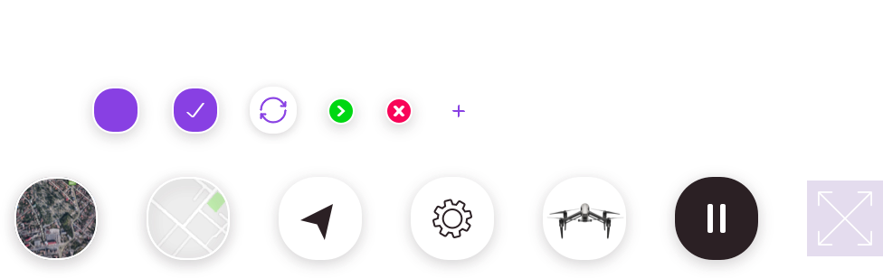
UI Components
Mobile App UI
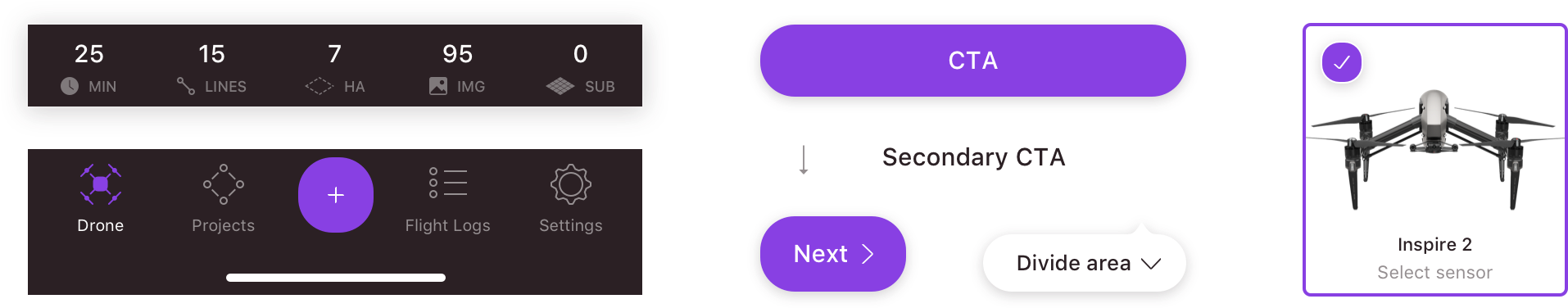
The main functionalities of the product are visible in the main navigation menu of the app. These are the action screens for the connected drone, the project list, flight logs for the drone, and app settings.
The main action button is reserved for the ability to create a new project, from definition, to flight plan mapping, to the captured photos’ back up and share function.

Creating new projects
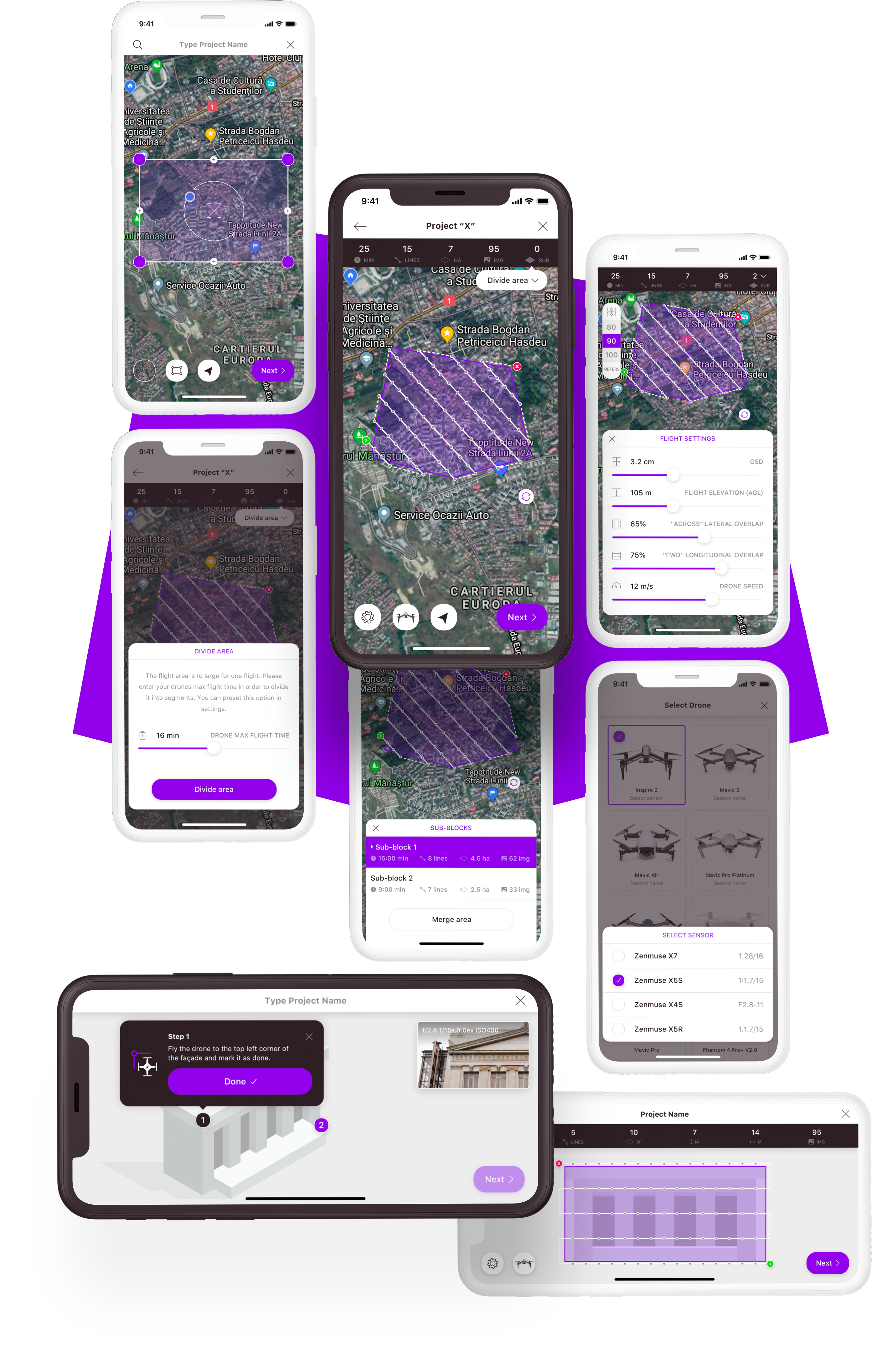
The user flow for creating a new project is broken down in three steps, to keep the information processing light for the user.
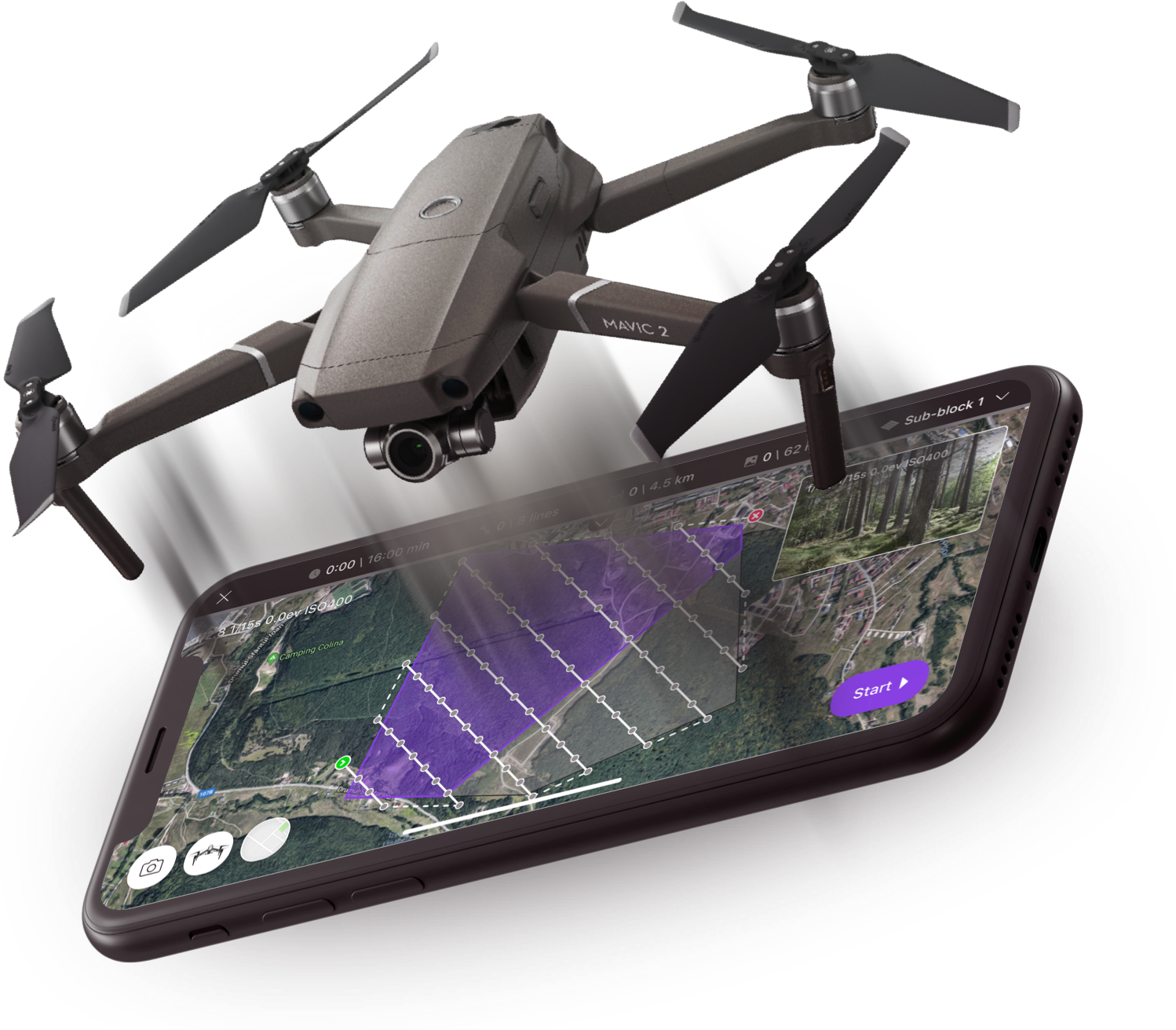
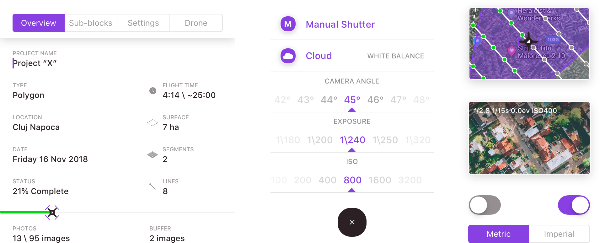
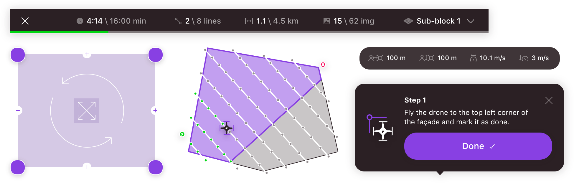
The first step is to name the project and define the terrain that needs to be surveyed. This can be done either through an imported KML file or manually in the map editor, where they can choose between a polygon, a grid, a linear type terrain shape, or a building facade.
These settings, as well as the specifics of the user’s drone, will generate flight lines for the path of the drone, with each line having multiple points where the drone will be required to capture a photo.
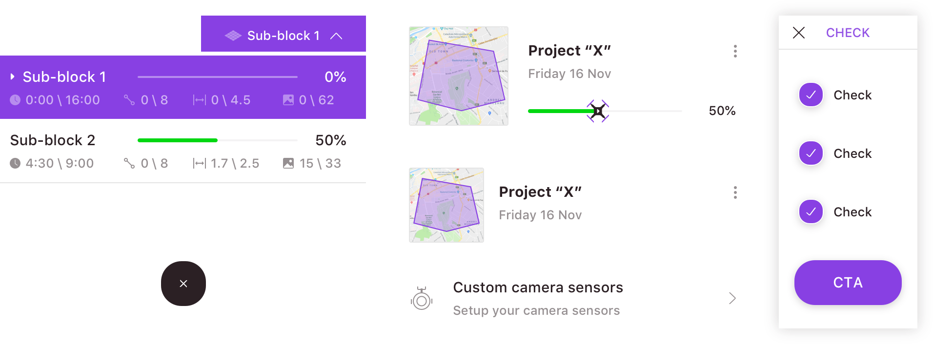
Note that if the flight pathways are longer that the actual flight capacity of the drone, the app will recommend breaking apart the shape into sub-blocks, and therefore the drone flights into respective missions.
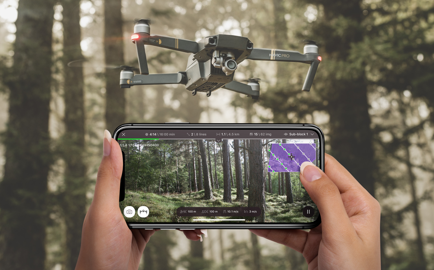
Flight mode
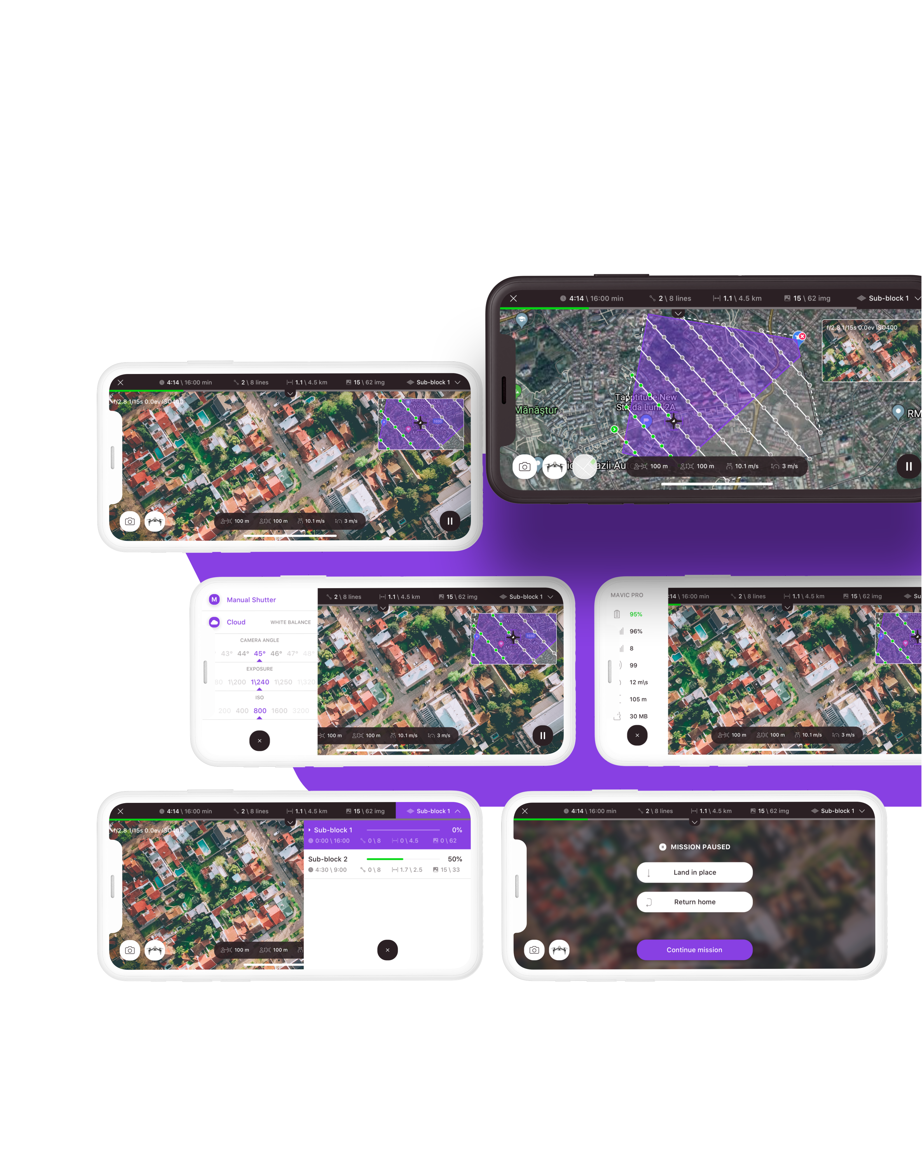
When launching a drone mission, the user is able to track the drone in real-time. They’ll be able to track battery levels, fidelity to the flight plan and percentage to completion.
The user can also make on-the-go changes to the flight lines and photo capturing positions, as well as pause or cancel the mission.
Over quota!
This share link cannot be viewed because this account is over quota. Reach out to the prototype owner for more information.
Interactive Prototype
Try out the high fidelity prototype of Tap2Map on Invision.
Used Technology

iOS
Tap2Map was built using Swift and the DJI iOS SDK. Libraries of trigonometry were adapted for the app, as well as polygon clipping and slicing algorithms.

Design
Both wireframing and the final UI design were done in Sketch, building a completely custom user experience. We use Invison for prototyping and collaboration on design.
#TappSquad

iOS Developer
Cătă
Product Designer
Marius